Subject: Iowa
Period: 1843 (circa)
Publication: A New Universal Atlas
Color: Hand Color
Size:
12.4 x 15.3 inches
31.5 x 38.9 cm
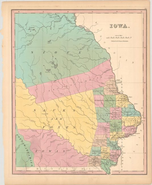
This early map of Iowa Territory depicts only twenty counties clustered along the Mississippi River in the southeast. There are a number of early settlements (many of which do not exist today) and roads depicted in this region. The lion's share of the territory is divided among Indian nations including the Sioux in the north, and the Sauks, Foxes, Iowas and Pottawattamies in the south. A large swath through the middle of the territory is labeled Neutral Ground. The northern boundary extends beyond the Falls of Anthony and Fort Snelling, and no western boundary is shown. County development is correct to 1842. The map was published by Carey & Hart just three years prior to Iowa's admission as a state.
References:
Condition: B+
Contemporary color with light toning along the sheet edges and a small stain at lower left.