Subject: Delaware
Period: 1824 (circa)
Publication: A New General Atlas...
Color: Hand Color
Size:
8.6 x 11.2 inches
21.8 x 28.4 cm
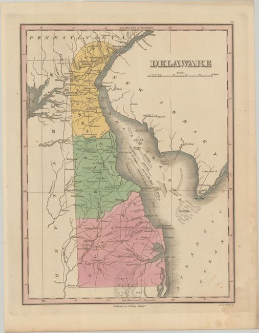
Finely's maps employ a delicate and elegant engraving style and provided extensive topographical and watershed information. He was the dominant map maker in the United States in the early 1820s into the 1830s. His atlases were very successful, outselling rival atlases by Carey & Lea, and Tanner. His maps were printed on high quality paper and were routinely corrected and updated.
This handsome map of the state details the county seats, roads, towns and settlements, and watershed. It shows a network of wagon roads between the major towns and villages. Locates Iron Hill, Christiana's Bridge, ferries, and mills. The Cypress Swamp is well drawn along the border with Maryland. Engraved by Young & Delleker. Finley published his atlases annually between 1824-1834, with one final edition appearing in 1836 (Ristow states his last atlas was 1834).
References: Phillips (Atlases) #752-16; Ristow pp 268-70.
Condition: B+
Contemporary color with light dampstaining at bottom right and some light spots.