Subject: Southwestern United States
Period: 1859-86 (dated)
Publication:
Color:
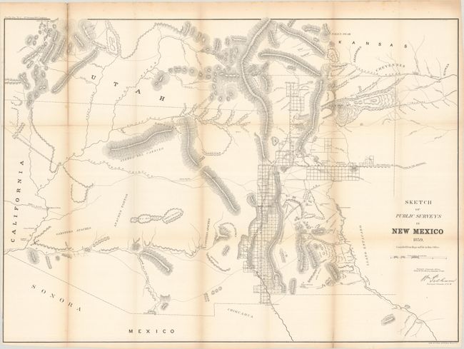
A. Sketch of Public Surveys in New Mexico, by General Land Office, from Sen. Ex. Doc. No. 2, 1st Session 36th Congress, dated 1859, black & white (32.5 x 23.3"). An early, large-scale, territorial map by the Surveyor Generals Office, Santa Fe, New Mexico. It includes all of today's Arizona and extends to includes portions of eastern California and southern Utah to the north. The area of present-day New Mexico is depicted with good surveying progress primarily in the settled areas of Santa Fe and along the valley of the Rio Grande River. Just to the west of the Rio Grande are "Copper and Gold Mines" (which do not appear in the 1857 edition), a few Indian villages, and basic detail of rivers and topography. Condition: Issued folding with light toning along the fold lines and a few minor fold separations closed on verso with archival tape. (B+)
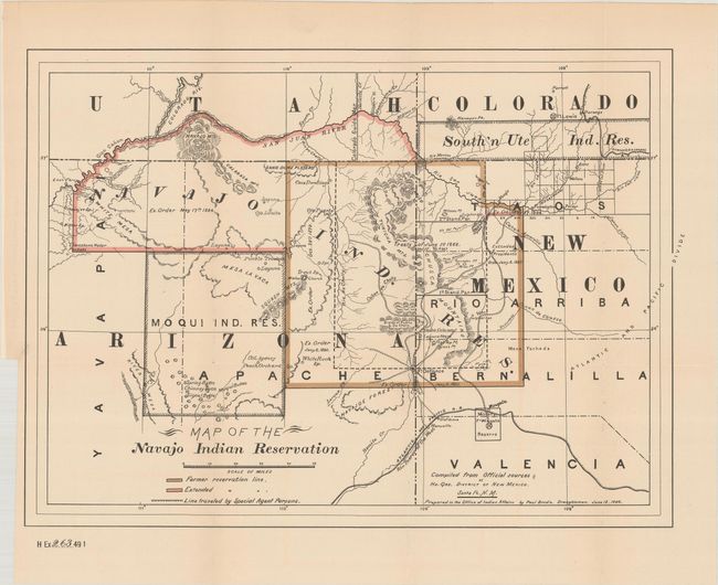
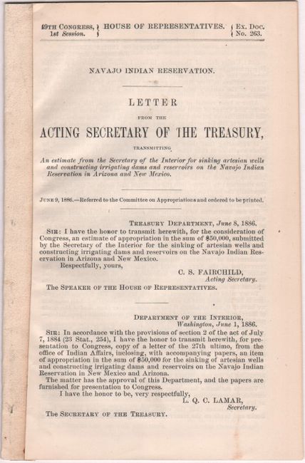
B. Map of the Navajo Indian Reservation, by Office of Indian Affairs, with Navajo Indian Reservation. Letter from the Acting Secretary of the Treasury..., published 1886, printed color (15.5 x 11.3"). This is a very detailed map of the Navajo Indian Reservation that shows an expansion of the reservation north of the Hopi Reservation and into southeastern Utah. There is interesting detail including cave dwellings, the Divide of Puerco & De Chelly, changes in boundaries with details, and more. Creeks, rivers, canyons, valleys, mountains, mesas, villages, lakes and passes are shown. The map locates and names the Hopi Mesas ("Buttes") Canyon de Chelly, Fort Defiance and Wingate, Laguna (Pueblo), Walker Church, White Rock Springs, the Crossing of the Fathers, and much more. The route traveled by Special Agent Parsons is illustrated. It is interesting to note that the lands gained in Utah are noted as removed by Executive Order on the 1892 edition of this map. In Colorado the Southern Ute Indian Reservation is located, as is Durango and a portion of the Denver & Rio Grande Railroad. Accompanied by the 19-page disbound report. Condition: The folding map has a tiny binding tear at left that has been closed on verso with archival tape, otherwise fine. Report text is clean and bright. (A)
References:
Condition:
See description above.