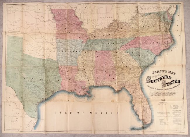
Subject: Southern United States, Civil War
Period: 1861 (dated)
Publication:
Color: Hand Color
Size:
52 x 37.1 inches
132.1 x 94.2 cm
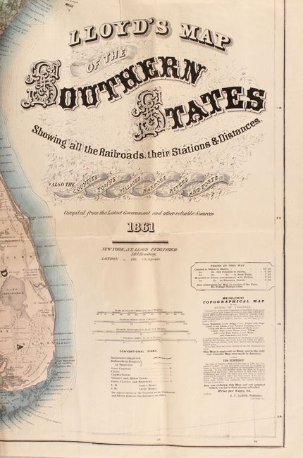
This is an early edition of this terrific Civil War map extending from the Mason-Dixon line south to Florida and west to Missouri and Texas. It is notable for being one of the few versions of the map to show the majority of Texas (most showed just far eastern Texas), highlighting its importance to the Confederacy. Details include county development, cities and towns, courthouses, forts, completed railroads and projected railroads. Features an advertisement at bottom right for Lloyd's "$100,000 Topographical Map of the State of Virginia" which he also issued in 1861 as an update to the Boye-Bucholtz map of 1859. The verso contains newspaper-style text describing counties in Virginia and Missouri with title "Lloyd's Military Map and Gazetter of the Southern States." According to Stephenson, Lloyd produced at least 5 editions of this map.
References: Stephenson (Civil War) #14.25.; TX GLO pp. 224-25.
Condition: B
Issued folding with one small stain and numerous small fold separations that have been closed on verso with archival materials. There is minor loss at a few fold junctions and two small triangular areas of loss at the top and bottom centerfold that have all been replaced with old paper on verso.