Subject: Colonial Southeast United States
Period: 1773 (dated)
Publication:
Color: Black & White
Size:
11.2 x 7.3 inches
28.4 x 18.5 cm
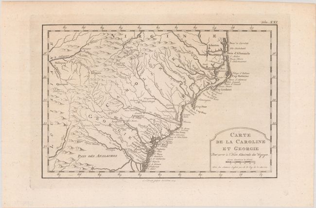
This is the Dutch edition of Bellin's delicately engraved map of the colonies of Carolina and Georgia from Albemarle Sound to the Altamaha River. It probably owes its origin to the 1752 map of the region by Emanuel Bowen. There are numerous English settlements along the coast and Indian villages are located throughout, including a number west of the Appalachian Mountains. There is more detail in the area west of the Blue Ridge than in many other maps of the period. It shows a rudimentary course of the Tennessee River in the northwestern section of the map. A simple and elegant title cartouche incorporates the distance scale. Engraved by A. van Krevelt for an uncommon Dutch edition.
References: cf. Cumming (SE) #444; cf. Sellers & van Ee #1384.
Condition: A
Issued folding.