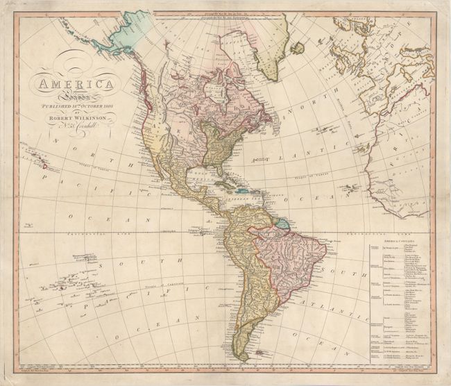
Subject: Western Hemisphere - America
Period: 1803 (dated)
Publication:
Color: Hand Color
Size:
23.5 x 20.3 inches
59.7 x 51.6 cm
This handsome and very uncommon map shows the United States east of the Mississippi. Although it was published on October 18th, 1803, just a few months following the Louisiana Purchase, the large Louisiana Territory is identified as a Spanish possession. The area between the Colorado or North River and R. Bravo (Rio Grande) is labeled New Mexico. The British possession New Albion comprises present-day California and the Pacific Northwest. Alyaska appears in rudimentary form with the Aleoutskiya Isles. A note off the coast of Owhyhee states "Ceded to England 1794. Greenland is shown connected to Canada, and the northern portions of Canada remain largely blank. A number of cities and rivers are named throughout. A table at bottom right identifies the various European possessions in the Americas. At the bottom of the table, the Native Americans are noted as being located in North America in Mosquito Shore &c. and in South America in Patagonia &c.
References:
Condition: B+
A nice impression with minor soiling and a few short centerfold separations that have been repaired with archival materials on verso. There is a light horizontal extraneous crease across the middle of the map with a couple tiny areas of loss.