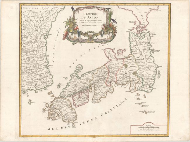
Subject: Japan & Korea
Period: 1786 (circa)
Publication: Atlas Universel
Color: Hand Color
Size:
21.3 x 19.1 inches
54.1 x 48.5 cm
Large, finely engraved map of Japan with a distinctively French style title cartouche containing two small landscapes. The map draws heavily on the previous work of Bellin, but includes a number of improvements to Terre d'Yedso (Hokkaido) similar to the manuscripts of Engelbert Kaempfer. The fictitious island of Matsumae is removed and now Matsaki is shown as a part of Yedso. The provinces are clearly outlined and there are many place names. The eastern part of the Korean peninsula is also shown with a good amount of detail. The sea between Korea and Japan is named both the Mer de Coree and the Mer du Japon reflecting a compromise to the long-standing dispute over the name of this sea. This great map was to influence the cartography of Japan into the 19th century. This is the later edition with the date removed from the cartouche, published by Charles Francois Delamarche, successor to the Robert de Vaugondys.
References: Hubbard #101; Walter plate #86; Pedley #410.
Condition: A
Contemporary outline color in the map with later color in the cartouche, on a bright sheet with the watermark of the Society of Jesus. There is minor soiling, mostly confined to the edge of the sheet.