Subject: Asia
Period: 1771 (circa)
Publication: Atlas Moderne
Color: Hand Color
Size:
17.6 x 12.1 inches
44.7 x 30.7 cm
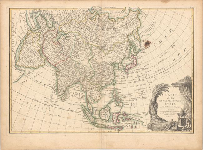
A beautifully engraved map that illustrates the state of geographic knowledge just prior to the momentous explorations in the Pacific that completed cartographic knowledge of the region. The North Pacific shows the sketchy concepts of the strait of Anian, Terre de Jean de Gama and a stretch of land supposedly sighted by Tschirikow and Delisle in 1741. The northern part of Japan is incompletely mapped and the sea between Japan and Korea is noted as the Mer de Coree, reflecting the Russian sources for much of the map. The stunning title cartouche features rich silks and tapestries, a smoking incense censor, and exotic jewels.
References: Yeo #141.
Condition: B
Contemporary outline color on sheet with the watermark of a Maltese cross encircled in rosary beads. There is light toning and soiling, an ink splotch in the north Pacific, a centerfold separation in the bottom blank margin, and a few tiny worm holes only visible when held to light.