Subject: Central Italy
Period: 1704 (circa)
Publication:
Color: Hand Color
Size:
19.5 x 14.9 inches
49.5 x 37.8 cm
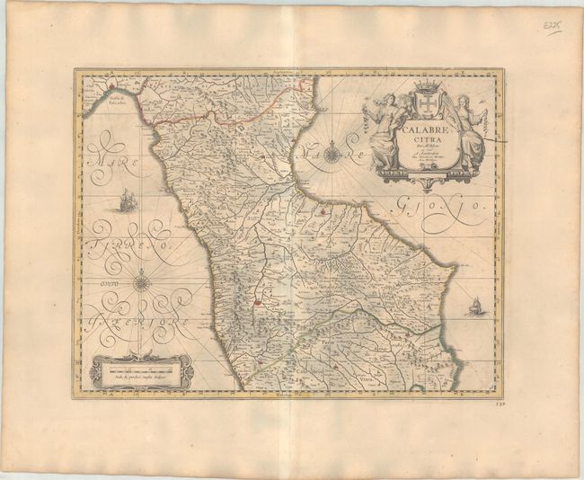
This lovely and decorative map covers the northern part of Calabria from the Gulf of Policastro across to the Gulf of Taranto, down past Cosenza to Nicastro, and west to Cape Colonna and Crotone. The Apennine Mountains are well rendered. The map is beautifully adorned with calligraphic script, compass roses, sailing ships, and a very decorative cartouche flanked with two maidens. There is another cartouche for the distance scale at bottom left. Blank verso. The map was originally included in Johannes Blaeu's magnificent Atlas Maior. It was among the plates that survived the 1672 fire that destroyed Blaeu's printing house, and this edition was issued by Covens & Mortier.
References: cf. Van der Krogt (Vol. II) #7491:2.
Condition: B+
A sturdy sheet with contemporary outline color, light offsetting and minor toning.