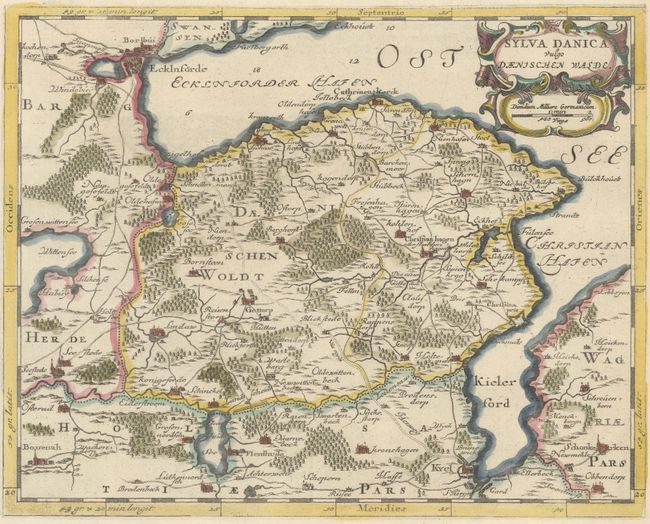
Subject: Northern Germany
Period: 1664 (published)
Publication: Grooten Atlas
Color: Hand Color
Size:
12 x 9.5 inches
30.5 x 24.1 cm
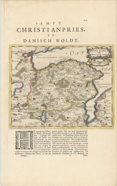
A handsome map of the eastern portion of Schleswig-Holstein, between Eckernforde and Kiel. There is good detail of towns, roads, and forested areas. Adorned with a strapwork title cartouche incorporating the distance scale. The map was originally created by surveyor and cartographer Johannes Mejer in 1649 for an atlas on Schleswig Holstein. The plates were later sold to the Blaeu family, who republished them in editions of the Atlas Maior between 1662-72. On a sheet of Dutch text (13.2 x 21.0").
References: Van der Krogt (Vol. II) #1650:2.2.
Condition: A
Watermarked paper with a short tear in left blank margin and a minor damp stain in top blank margin, neither affecting map.