Catalog Archive
Auction 182, Lot 513

"Carte Historique et Geographique des Royaumes d Espagne et de Portugal Divises Selon Leurs Royaumes et Provinces", Chatelain, Henry Abraham

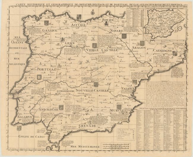
Subject: Spain & Portugal

Period: 1720 (circa)

Publication: Atlas Historique

Color: Black & White

Size:
21.2 x 17.3 inches
53.8 x 43.9 cm
Download High Resolution Image
(or just click on image to launch the Zoom viewer)

Beautiful and very detailed map of Spain and Portugal. It includes the Strait of Gibraltar and shows coats of arms and substantial details throughout the map. An interesting key at the bottom provides information on major cities, including those having universities, royal palaces, cathedrals, and even those where the Inquisition was held.

References:

Condition: A

A sharp impression issued folding on a slightly toned sheet with a large elephant watermark. There is faint offsetting and some minor extraneous creasing.

Estimate: $190 - $220

Sold for: $120

Closed on 4/28/2021

Archived