Subject: France
Period: 1618 (published)
Publication: Theatrum Geographiae Veteris...
Color: Hand Color
Size:
19.4 x 15.5 inches
49.3 x 39.4 cm
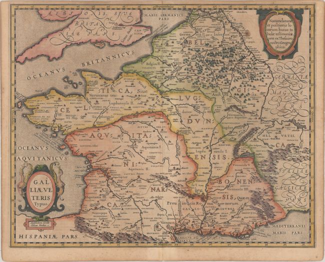
A lovely map of France during Roman times based on ancient geographical sources including Strabo, Plinius, Virgilius, Ovidius and Caesar. The map is filled with detail and ancient place names. Two ships sail in the stipple engraved oceans and the map is decorated with two fine cartouches. This is the second state with Marseille now appearing as Massilia rather than Marsilia and Sequani added northwest of the Jura mountain range. Latin text on verso, published in Bertius' Theatrum Geographiae Veteris.
References: Van den Broecke #196.
Condition: B+
A nice impression with a small paper flaw adjacent to the cartouche at top right, and light toning and foxing.