Subject: Western Europe, World War II
Period: 1940 (circa)
Publication:
Color: Printed Color
Size:
28.5 x 38.3 inches
72.4 x 97.3 cm
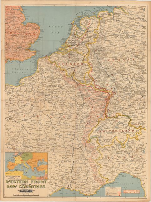
This informative map depicts the Western Front during World War II. It spans from Angers to Nuremberg and extends to show parts of England and Italy. A key at bottom right identifies international boundaries, railways, canals, the Maginot and Siegfried lines, forts, and naval bases. The map also delineates French and German fortified areas. An inset at bottom left locates the naval bases in the Mediterranean. Published in Sydney, Australia by H.E.C. Robinson Pty. Ltd. The publisher's imprint is obscured by a label for Swain's Stationery, Books, Artware, Fancy Goods.
References:
Condition: B
Issued folding with some short splits at fold intersections. There is light scattered foxing and some light dampstains.