Subject: Netherlands
Period: 1792 (circa)
Publication: Bowles's Universal Atlas...
Color: Hand Color
Size:
23.6 x 18.3 inches
59.9 x 46.5 cm
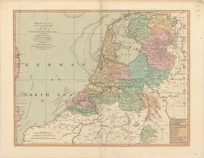
This uncommon map of the Netherlands is derived from the maps of Jean Palairet and Tobias Mayer. Most of the detail is focused on the Netherlands, with plenty of place names and watershed. The map extends into Northern France and Belgium, showing Calais, Bruges, Brussels, Ghent, and Antwerp. It also includes part of western Germany and a sliver of England. The Broad Fourteens are identified in the North Sea. A key at bottom right presents a "Methodical Division, of the Seven United Provinces." Three distance scales appear at bottom left. Published by Bowles & Carver at No. 69 in St. Paul’s Church Yard.
References: Shirley (BL Atlases) T.BOWL-2a #14.
Condition: B+
Contemporary color with light toning along the centerfold, minor soiling, and printer's ink residue. There are printer's creases to the left of the centerfold at top and bottom.