Subject: Southern Scotland
Period: 1657 (circa)
Publication: Atlas Nuevo de los Reynos de Escosia e Yrlanda
Color: Hand Color
Size:
21.8 x 14.9 inches
55.4 x 37.8 cm
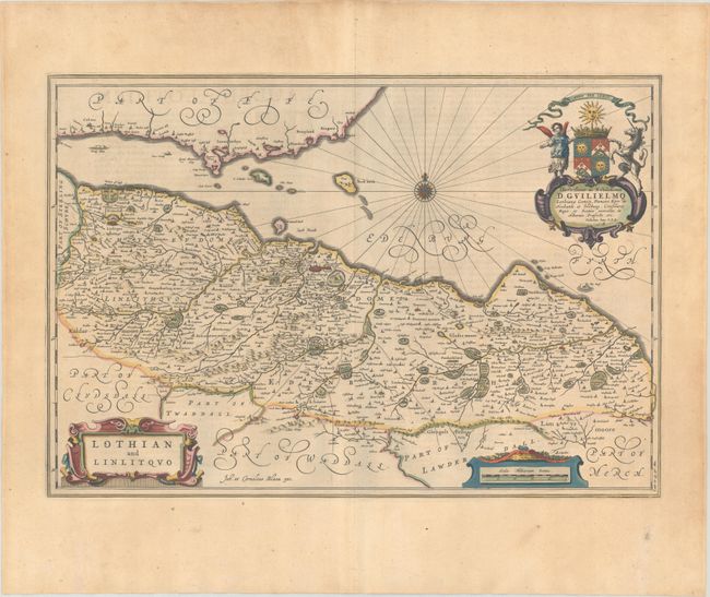
Splendid map covering Lothian and centered on Edinburgh. Map is covered with topographical detail, forests and castles. It is decorated with three decorative cartouches including a dedication with a beautiful coat of arms in full color. Large compass rose and three ships sail in the Firth of Forth. Spanish text on verso, published between 1654-62.
Publication of Bleau’s atlas of Scotland (Atlas Novus, Volume V) in 1654 was a landmark publication in cartographic history. Most of the maps were based on the surveys of Timothy Pont, which had been done half a century earlier. The publication took over seven decades to bring to publication; it was delayed by wars, copyright restrictions, and only intermittent official support. The maps are scarce today due to the relatively short publication history of the atlas.
References: Van der Krogt (Vol. II) #5815:2.
Condition: A
A crisp impression with full contemporary color on a sheet with a large Atlas watermark, a hint of toning, and marginal soiling.