Subject: Southeastern England
Period: 1675 (circa)
Publication: Britannia
Color: Hand Color
Size:
17 x 12.2 inches
43.2 x 31 cm
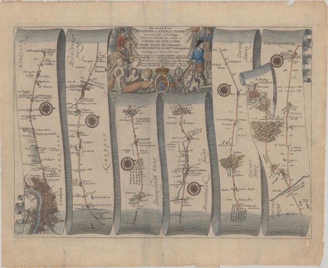
John Ogilby's 'Britannia' was published between 1675 and 1698. It is a landmark in the mapping of England and Wales. Its unique format constituted the first national road-atlas of any country in Western Europe. It was composed of maps of seventy-three major roads and cross-roads, presented in a continuous strip-form, on a uniform scale of one inch to a mile. Each beautiful map includes wonderful detail of the countryside with each strip containing a large compass rose to indicate changes in direction.
Attractive strip-style map covering the road from London to Oxford and Islip in six strips totaling 58 miles. The map begins with a fine plan of London and proceeds to the west and northwest as it passes through Uxbridge, Beaconsfield, High Wycombe, and Tetwsworth. The sixth strip splits to show roads to Oxford and Islip. Each of the panels has a decorative compass rose to orient the traveler. The title cartouche features surveyors, several putti, and the royal coat of arms.
References: Shirley (BL Atlases) T.OGIL-4a #1.
Condition: B+
There is light soiling, some extraneous creasing adjacent to the centerfold, and a few tears at bottom that have been closed on verso with archival material, including one that just enters into the map image.