Subject: Western South America
Period: 1780-1850 (circa)
Publication:
Color: Hand Color
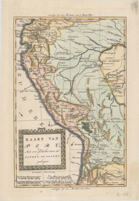
A. Kaart van Peru, met een Gedeelte van de Landen ten Oosten Gelegen, by Bonne/Bachiene, circa 1790 (8.1 x 12.3"). A bold title cartouche embellishes this nice map of the western part of South America. It covers from Popayan, Columbia, to San Miguel de Tucuman in Argentina. The headwaters of the Amazon and Lake Titicaca are prominently depicted. Condition: A crisp impression on a bright sheet with an "IV" watermark. There is some minor soil in the blank margins, not affecting the map.
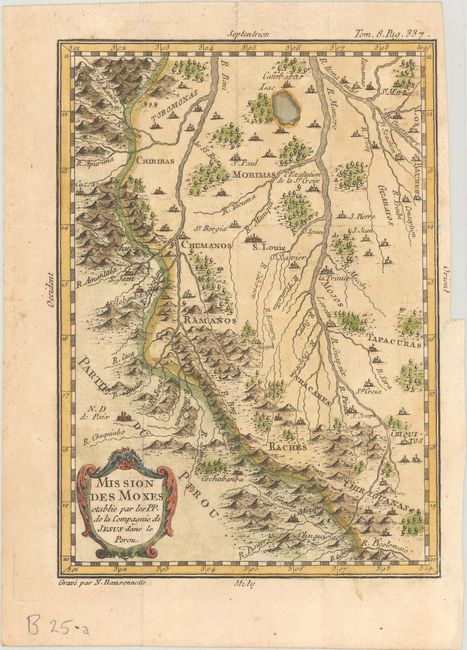
B. Mission des Moxes Etablie par les PP. de la Compe. de Jesus dans le Perou, by N. Ransonnelle, from Lettres Edifiantes et Curieuses, published 1780 (5.1 x 7.1"). Finely engraved map of the region east of Cuzco. The map shows the topographical details and location of the numerous Jesuit missions, in addition to locating Cuzco. Strapwork title cartouche. Engraved by N. Ransonnette. Condition: At right are a binding trim and a tiny, archivally repaired binding tear, not entering image. Folds as issued.
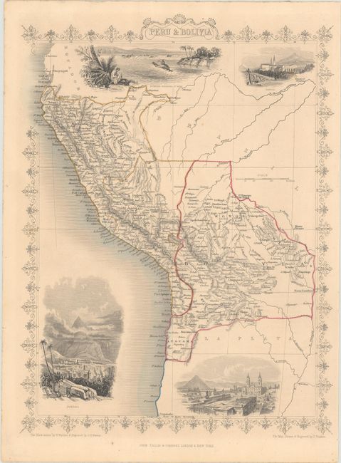
C. Peru & Bolivia, by John Tallis, from Illustrated Atlas and Modern History of the World, circa 1850 (9.9 x 13.2"). This steel-engraved map features good detail and four beautifully engraved vignettes: Swimming Couriers of Peru, Tarija, Potosi, and Lima. Parts of Ecuador, Brazil, and La Plata are visible but largely unengraved. The illustrations were drawn by H. Winkles and engraved by J.H. Kernot; J. Rapkin drew and engraved the map. Condition: Contemporary outline color and minor toning and soiling.
References:
Condition: A
See description above.