Catalog Archive
Auction 182, Lot 422

"Le Bresil, dont les Cotes sont Divisees en Capitaineries Dresse sur les Dernieres Relations des Flibustiers et Fameux Voyageurs", Fer, Nicolas de
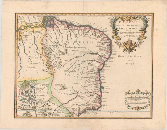
Subject: Brazil

Period: 1719 (dated)

Publication: Atlas ou Recueil de Cartes Geographiques...

Color: Hand Color

Size:
21.4 x 16.4 inches
54.4 x 41.7 cm
Download High Resolution Image
(or just click on image to launch the Zoom viewer)

Large, handsome map showing the Portuguese possessions in Brazil. The coastal regions were divided by the Portuguese Crown into fourteen Capitaineries or hereditary harbor offices. The holders of these grants, called donees (donatários), were responsible for their defense and development. Another interesting feature of this map is the cluster of swamps and Lagunes des Zarajes near the headwaters of the Paraguay River and several notations in the interior. The map is embellished with decorative title and scale cartouches.

References: Pastoureau, FER II C [98].

Condition: B+

A sharp impression on a sturdy sheet with a rosary beads watermark. There is light, scattered foxing, a few archivally repaired tears in blank margins, and faint damp stains at top and bottom.

Estimate: $500 - $650

Sold for: $335

Closed on 4/28/2021

Archived