Subject: Northwestern South America, Panama
Period: 1800 (dated)
Publication:
Color: Hand Color
Size:
22.3 x 33.9 inches
56.6 x 86.1 cm
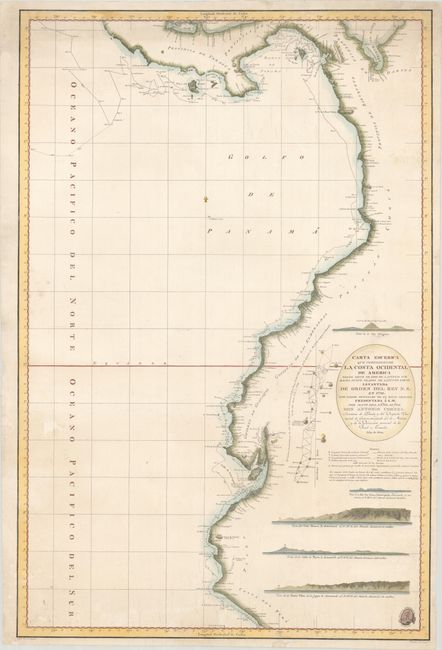
This large and impressive chart spans from the Gulf of Panama south to northern Peru. The chart features plenty of detail along the coast, including anchorages, soundings, navigational hazards, currents, coastal islands, and settlements. It traces the routes of the Descubierta and Atrevida, the ships of the Malaspina Expedition, the most important voyage of discovery dispatched by Spain in the 18th century. Commanded by Alessandro Malaspina and José de Bustamante y Guerra, the goals of the expedition were to increase geographic and scientific knowledge and to monitor the status of the Spanish empire. Over four years, the ships traveled from Cadiz, Spain, to South America, Alaska, and Australia before returning home to Spain. The chart also includes a diagram around Quito that illustrates the work of the French Geodesic Mission, an expedition that was to measure the roundness of the earth and determine the length of a degree of latitude at the Equator. There are also five views of the coast from the ocean. This map was drawn by Felipe Bauza, Malaspina's chief chart maker, and engraved by Fernando Selma. The insignia of the Direccion de Hidrografia appears in the bottom right corner.
References:
Condition: B
A nice impression on a watermarked sheet with two small holes in blank areas adjacent to the left border that have been closed on verso with archival materials. A few edge tears at top and bottom have also been archivally repaired on verso.