Subject: South America
Period: 1700 (circa)
Publication: A New Sett of Maps Both of Antient and Present Geography…
Color: Black & White
Size:
19.1 x 14.3 inches
48.5 x 36.3 cm
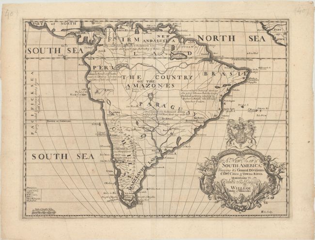
This uncommon and handsome map of South America includes little detail except for missions and notes concerning European discoveries, such as a note in Brazil that the Portuguese discovered the region about 1501 but "possess little more than the coasts; the inland parts being inhabited by Barbarous Nations who still maintain their freedom." Buenos Aires, Lima, Cusco, Quito, and Salvador are among the cities named. The fictitious Parima Lake appears north of the Amazon, and there is a large lake with several islands in it at the center of the continent with several rivers branching off it, including the Parana. A very large elaborate title cartouche features the British coat of arms and is dedicated to William Duke of Gloucester, who was Wells' student at Oxford. Engraved by Benjamin Cole.
References: Shirley (BL Atlases) T.WELL-1a #40
Condition: B+
There is light scattered foxing and soiling, a printer's crease at right, and a few tiny wormtracks at top.