Subject: Martinique
Period: 1764-1843 (circa)
Publication:
Color: Hand Color
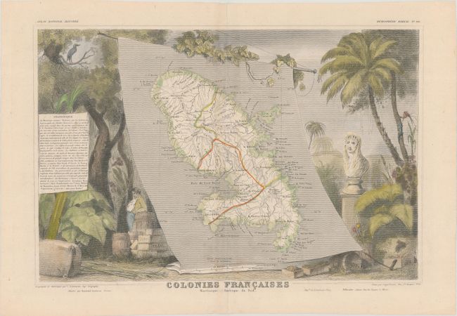
A. Colonies Francaises Martinique Amerique du Sud, by Victor Levasseur, from Atlas National Illustre, circa 1843 (15.9 x 10.6"). Lovely map of the island of Martinique displayed on a banner scroll, surrounded by steel engraved vignettes featuring the riches of the colony. Empress Josephine, the wife of the Emperor Napoleon, was born on this island, and is shown in a bust at the right. Engraved by Laguillermie. Condition: There are light spots around the lower centerfold. (B+)
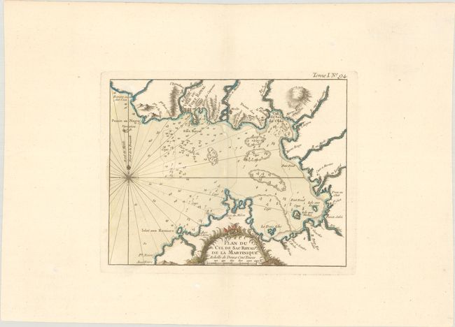
B. Plan du Cul de Sac Royal de la Martinique, by Jacques Nicolas Bellin, from Le Petit Atlas Maritime, circa 1764 (8.3 x 6.6"). This small but detailed chart depicts Fort-de-France Bay on the western coast of Martinique. The island's capital, Fort Royal (now known as Fort-de-France) appears in miniature plan form. There is plenty of navigational information in the bay, including soundings, anchorages, and cays. A compass rose capped with fleur-de-lis radiates rhumblines at left. The title and distance scale are enclosed in a decorative cartouche at bottom. Condition: A nice impression on a watermarked sheet with wide margins. (A)
References:
Condition:
See description above.