Catalog Archive
Auction 182, Lot 399
NO RESERVE
"Isle St. Christophle une des Antilles aux Anglois [on sheet with] La Barbade une des Antilles aux Anglois Divisee par Paroises ", Le Rouge, George Louis
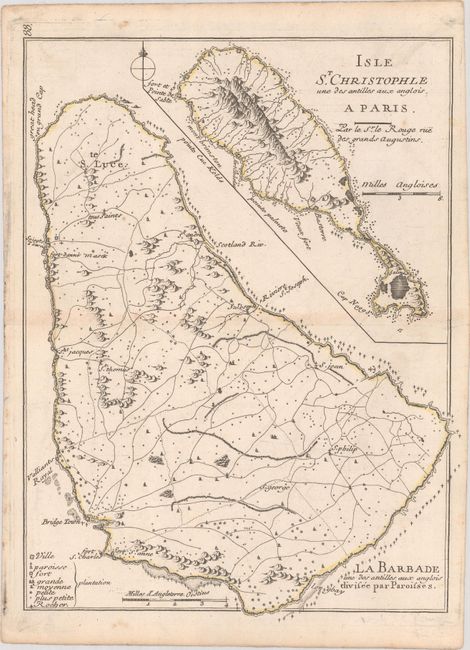
Subject: St. Kitts & Barbados
Period: 1748 (circa)
Publication: Atlas Nouveau Portatif…
Color: Hand Color
Size:
8.2 x 10.9 inches
20.8 x 27.7 cm
Download High Resolution Image
(or just click on image to launch the Zoom viewer)
(or just click on image to launch the Zoom viewer)