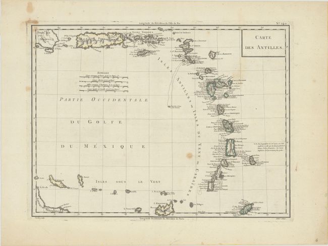
Subject: Puerto Rico & Lesser Antilles
Period: 1795 (circa)
Publication:
Color: Hand Color
Size:
16.9 x 12.6 inches
42.9 x 32 cm
This chart of the Lesser Antilles extends from the eastern tip of Hispaniola through the Antilles to include Marguerite, Tobago and Curacao. It contains a dense listing of place names, more than most charts from this period. Good detail of Porto Rico, the Virgin Islands and St. Croix. The chart uses two standards to measure Longitude: Paris and the Isle de Fer in the Canary Islands. The Canary Island standard was first proposed by Ptolemy as this was at the time the western boundary of the known world. Various islands in the Atlantic Ocean were used as zero longitude until 1634, when an a committee organized by Cardinal Richelieu selected the Isle de Fer. Engraved by Tardieu and drawn by Andre.
References:
Condition: B
A crisp impression with several small stains and toning in the right blank margin.