Subject: Hispaniola
Period: 1806 (dated)
Publication: The History, Civil and Commercial, of the British Colonies in the West Indies...
Color: Black & White
Size:
28.8 x 18 inches
73.2 x 45.7 cm
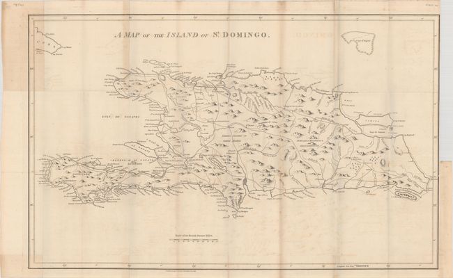
This large and interesting map of Hispaniola was made during a period of tumult as the people of the island struggled to establish independence from Spanish and French control. A dashed line indicates the "Demarcation line between the French & Spaniards as fixed in 1776." A public road system is clearly marked, and the rivers are well delineated. The illustration of topography has yet to achieve a degree of sophistication, but place name detail is good and reflects the French and Spanish influence. The distance scale uses British Statute Miles. Published by Stockdale. Although this comes from the same plate as the 1800 edition of the map, 18 centimeters have been trimmed from the plate at left, cutting off some of the Cuban coastline.
References:
Condition: B+
A crisp impression issued folding on a sheet with a "1794" watermark. There is light offsetting, scattered foxing, and some light toning along some of the folds. There is a 3.5" binding tear at right and some paper weakness in the left blank margin, both of which have been closed on verso with archival tape.