Subject: North Pole
Period: 1753 (circa)
Publication: Atlas Geographicus...
Color: Hand Color
Size:
11.9 x 12.1 inches
30.2 x 30.7 cm
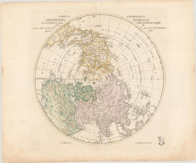
This interesting and uncommon polar map shows the fictitious West-Meer, or Sea of the West prominently with an extensive river system connecting it with the Great Lakes and thus forming a Northwest Passage. The mythical See Velasco is named near present-day Alaska with a note about Admiral de Fonte's mythical journey across the Northwest Passage in 1640. Johann Cristoph Rhode (1713-1786) was an active publisher in Berlin during the 1740s and 50s and is best known for his important French and Indian War maps. This map was prepared for the Royal Prussian Academy of Sciences and was published in Leonhard Euler's Atlas Geographicus. The customary Prussian privilege seal is shown at lower right. It is the first state, with "3. Hemisphaerium Boreale" at bottom right.
References: McGuirk #27.
Condition: A
Contemporary color on a sheet with a Strasbourg Lily watermark and marginal toning.