Subject: Gulf of Mexico & Caribbean
Period: 1806 (dated)
Publication:
Color: Hand Color
Size:
31.6 x 19.1 inches
80.3 x 48.5 cm
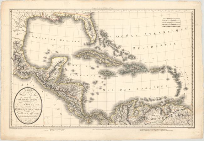
This scarce large-scale map of the Gulf of Mexico shows the European possessions through a color-coded key adjacent to the title cartouche. The regions and islands controlled by the French, Spanish, British, Danish, Dutch, and Swedish are shown, along with the area belonging to the United States. This map was published shortly after the Louisiana Purchase in 1803, and shows the United States in control of Louisiana. Florida is divided into East and West, and extends to the Mississippi River. There is great topographical detail throughout, and rivers and place names fill the map. Engraved by Tardieu and separately issued in Paris by Tardieu and Dezauche.
References:
Condition: B+
A crisp impression on a bright sheet with a few faint dampstains in the bottom corners.