Subject: Panama
Period: 1788-1883 (circa)
Publication:
Color:
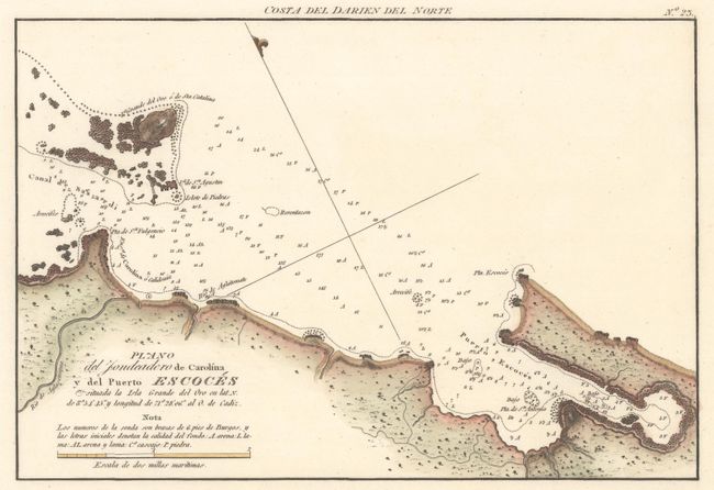
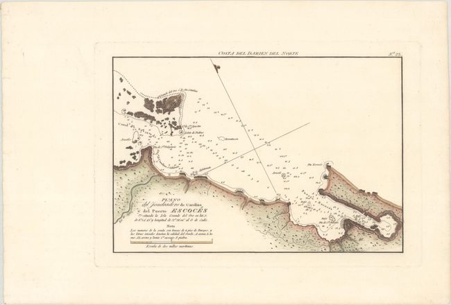
A. Plano del Fondeadero de Carolina y del Puerto Escoces..., by Direccion de Hidrografia, from Portunlano de la America Setentrionale, circa 1809, hand color (10.5 x 7.1"). This handsome and informative chart depicts Puerto Escoces in the Gulf of Darien. It features plenty of navigational information in the water, including soundings, hazards, and bottom type. There is some nice topographical detail along the coasts. The region depicted here was the site of the attempted Scottish colony of New Caledonia in the late 17th century. An alternate title runs above the upper neatline: Costa del Darien del Norte. Reference: Kapp (MCC-73) #95-2; Phillips (A) #1223 Pt. 2, #23. Condition: A fine impression with wide margins.
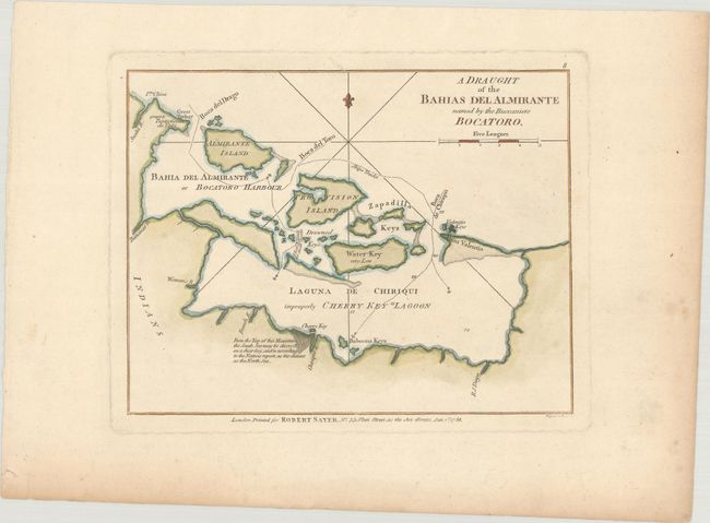
B. A Draught of the Bahias del Almirante Named by the Buccaniers Bocatoro, by Robert Sayer, from A New and Accurate Chart of the West-India Islands..., dated 1788, hand color (8.8 x 6.8"). This map shows Almirante Bay, Laguna de Chiriqui, and the Bocas del Toro Archipelago in northwestern Panama. It includes soundings, anchorages, routes, and more. Engraved by Wigell and Creed. Reference: cf. Kapp (MCC-73) #85-3; Shirley (BL Atlases) M.SAY-4a #8. Condition: On watermarked paper with some faint spots and marginal toning and soiling.
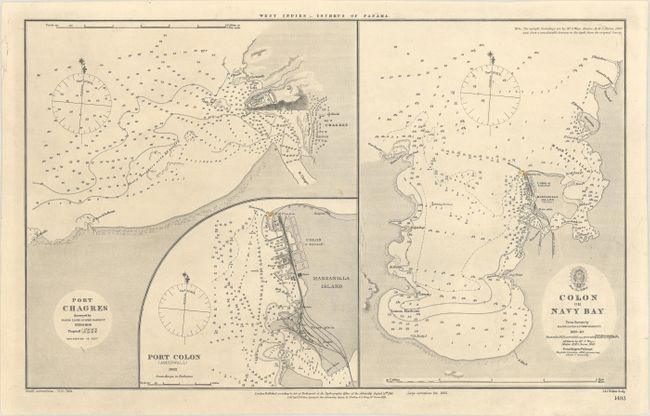
C. Port Chagres [on sheet with] Port Colon (Aspinwall) [and] Colon or Navy Bay, by Hydrographic Office of the Admiralty, dated 1883, black & white (17.3 x 10.6"). This sheet features three detailed charts depicting Chagres, Colon, and Limon Bay. Each chart is teeming with navigational information. The chart at left is based on surveys from Major Lloyd and Commader Barnett in 1829 and 1840. It shows Chagres and Lorenzo Castle in miniature plan form. The Port Colon chart is dated 1882 and depicts the city (also called Aspinwall by its United States emigre community) in plan form with nice detail of its railroads. This plan is interesting in that in precedes the Burning of Colon in 1885 by only a few years. At right is the largest chart, which zooms out to show the entirety of Limon or Navy Bay. It is based on the surveys of Barnett and Lloyd, with updates over the years. Condition: There is some minor soiling.
References:
Condition: A
See description above.