Subject: Central America
Period: 1850 (circa)
Publication:
Color: Hand Color
Size:
31.5 x 23.5 inches
80 x 59.7 cm
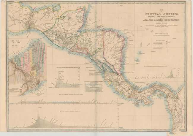
This handsome map of Central America illustrates the various proposed routes for a land transit that would cut weeks off a journey from the Atlantic to the Pacific. The map shows four possible routes: Across the Isthmus of Tehuantepec; from Port Sn. Juan del Norte to Port Realejo; between Charges (Atlantic) and Vaca de Monte (Pacific); and from the Lake Nicaragua to Port San Juna del Sur. A large and very colorful inset shows the geological formations on the Isthmus of Panama and the planned route in great detail. This chart gained particular prominence with the discovery of gold in California and was copied in a U.S. government report, also published in 1850.
References:
Condition: B+
Minor soiling with several separations along the centerfold that have been archivally repaired on verso. There are a few short tears along the edges of the sheet, and the sheet is trimmed to the neatline at bottom, as issued. The extension at bottom right is attached with archival tissue.