Subject: Western United States & Mexico
Period: 1857-58 (dated)
Publication: United States & Mexican Boundary Survey
Color: Black & White
Size:
22.9 x 20.6 inches
58.2 x 52.3 cm
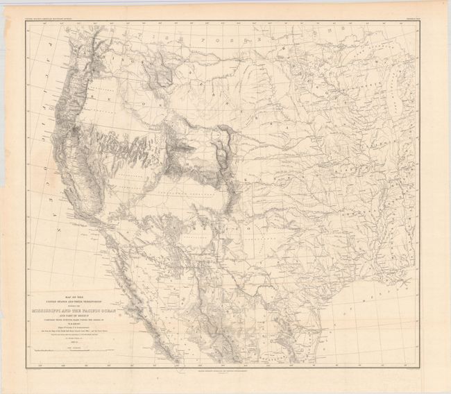
This map is one of the foundation maps for the western United States and represents the culmination of fifty years of government explorations. Starting with Lewis and Clark, there were numerous official and unofficial surveys and explorations, all adding to the pool of knowledge presented here. While large sections are still labeled "unexplored territory," Emory fitted these fragments together with the information gathered during his surveys into a reasonably correct cartographic picture of the West. This map shows large, transitional territories of Nebraska, Kansas, New Mexico, Utah, Oregon, Washington and Minnesota. It was drawn by Thomas Jekyll under the supervision of Lt. Nathaniel Michler of the Topographical Engineers. Lt. Michler worked with his counterpart representing Mexico, Captain Francisco Jimenez, to survey between Nogales and Yuma including the area south of Arivaca.
References: Wheat (TMW) #916.
Condition: B+
Issued folding with a few spots of foxing and minor extraneous creasing at bottom left. A short fold separation confined to the bottom blank margin has been closed on verso with archival tape.