Subject: Southern United States, Mexico & Central America, Texas
Period: 1838 (circa)
Publication:
Color: Hand Color
Size:
19.7 x 16.4 inches
50 x 41.7 cm
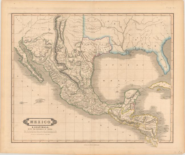
This handsome and scarce map prominently features the Republic of Texas, and depicts the southern United States, Mexico and Central America. The Independent Republic of Texas is bound by the Red River in the north, the Sabine River in the east, and in between the Nueces and Rio Grande (Rio Bravo del Norte) Rivers in the south. Mexico is divided into the Intendancies and Guatemala takes in all of Central America except for the British colony of Belize. New Mexico is shown as a narrow strip of land along the upper Rio Grande River, and most of New California is noted as Unknown Parts. The roads (El Camino Real) connecting Natchitoches and Santa Fe with Mexico City are prominently delineated, and numerous mines are located with small crosses. A desirable map for any Texas collection.
References:
Condition: B+
A nice impression with a hint of light toning and offsetting.