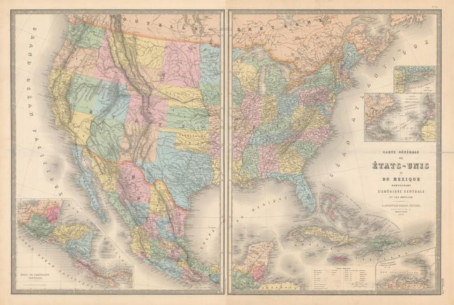
Subject: United States & Mexico
Period: 1870 (dated)
Publication: Atlas Universel
Color: Hand Color
Size:
18.5 x 24.3 inches
47 x 61.7 cm
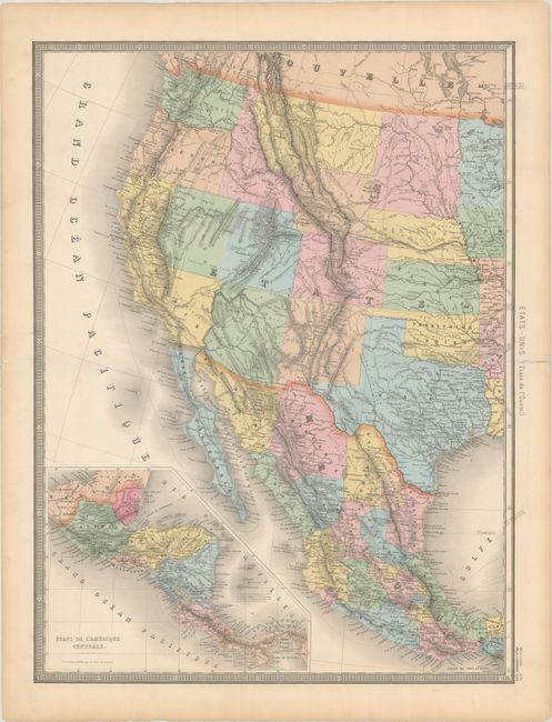
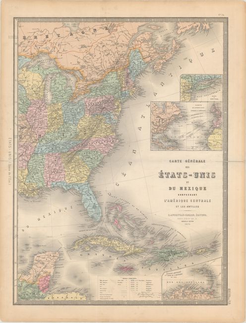
This attractive French map of covers the United States, Mexico, Central America, and the Caribbean on two sheets (dimensions are shown for each sheet). Insets at bottom show the Lesser Antilles and Central America. Above the title two additional insets show the telegraph cables throughout the Atlantic Ocean, and the details of New York and Long Island. In the United States there is only one Dacotah, and Indian Territory is still solely in the hands of the Native Americans. The map features a truly unusual configuration of California. Its western boundary follows the Sierra Nevadas and then extends to include the southern portion of present-day Nevada, which contains Las Vegas, here named Vegas de Quintana. A color key identifies the various European possessions.
References:
Condition: B+
There are centerfold separations at left and right on both sheets that have been closed on verso with archival materials. There is minor scattered foxing and light toning in the blank margins. The first image is a composite image - the map is on two separate sheets.