Catalog Archive
Auction 182, Lot 342

NO RESERVE

"Map of a Part of Washington Territory Lying East of the Cascade Mountains to Accompany Report of Surveyor General", Tilton, James
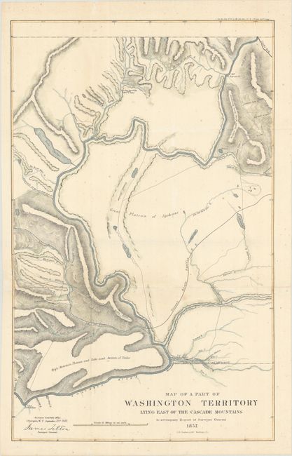
Subject: Washington

Period: 1857 (dated)

Publication: Sen. Ex. Doc. 11 & Ho. Ex. Doc. 2, 35th Congress, 1st Session

Color: Hand Color

Size:
13.9 x 22.1 inches
35.3 x 56.1 cm
Download High Resolution Image
(or just click on image to launch the Zoom viewer)

This uncommon and very detailed map covers the Columbia River from Ft. Dallas eastward to Ft. Walla-Walla, and north to Ft. Colvill. The Great Plateau of Spokane spans the center of the map. In the upper right corner the Gold Mines are shown along the Western limits of the Rock Mountains. Steven's survey route for the Pacific Railroad, creeks, rivers, lakes, roads, the Old Presbyterian Mission are also shown. The map was prepared by James Tilton, Surveyor General, Olympia, Washington Territory.

References:

Condition: B

Issued folding, now flat, with tissue reinforced folds. There is light scattered foxing and a long horizontal separation running along the lower fold that has been repaired on verso with archival materials.

Estimate: $90 - $120

Sold for: $140

Closed on 4/28/2021

Archived