Subject: Texas, Gulf Coast
Period: 1856-59 (dated)
Publication:
Color: Black & White
The Office of Coast Survey is the oldest U.S. scientific organization, dating from 1807 when Congress directed that a "survey of the coast" be carried out. By 1836, it was called the U.S. Coast Survey and in 1878, the name was changed to the U.S. Coast and Geodetic Survey. Today the Office of Coast Survey is a division of the National Oceanic and Atmospheric Administration NOAA.
The survey teams, composed of civilians as well as Army and Naval officers, charted the nation's waterways and produced a wide array of reports, survey charts, hydrographic studies of tides and currents, astronomical studies and observations, and coastal pilots. These charts are an important record of the changing nature of the nation's coastlines. In additional to coastal charts, the U.S. Coast and Geodetic Survey produced land sketches, Civil War battle maps, and the early aeronautical charts.
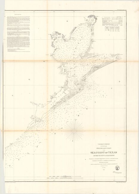
A. Preliminary Chart of the Sea Coast of Texas in the Vicinity of Galveston, dated 1856 (19.4 x 26.9"). This chart is centered on the city of Galveston, but continues northward to show the entire bay. It extends on the coast west beyond Oyster Bay, and east beyond Bolivar Peninsula to Muscle and East Bay points. Details include buoys and beacons, a light boat, shoals, reefs, and is filled with soundings, bottom types, extensive notations on sailing directions, tides, etc. In Galveston Bay, the mouth of the San Jacinto is depicted as is Turtle Bay. Condition: Light toning along the fold lines. The chart has been trimmed to just inside the left neatline at top and bottom by the binder.
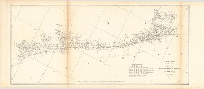
B. Sketch I Showing the Progress of the Survey in Section No. IX, dated 1859 (22.8 x 10.1"). A small chart showing the extensive triangulation work in the region from 1848-59 including Aransas Bay, Matagorda Bay, and Galveston Bay. Condition: Light toning along the fold lines.
References:
Condition: B
Issued folding. See description above.