Subject: Western Nevada
Period: 1882 (published)
Publication:
Color: Printed Color
Size:
18.2 x 27.3 inches
46.2 x 69.3 cm
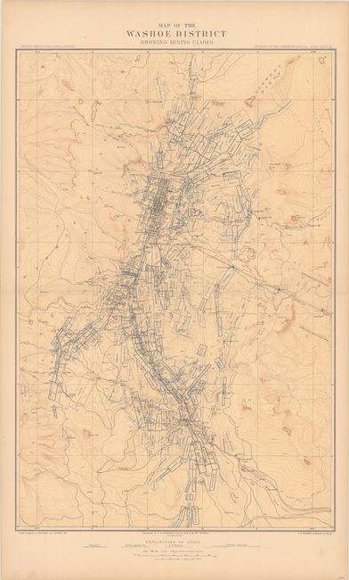
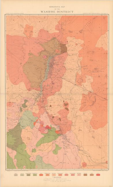
These two maps were issued in the Atlas to Accompany the Monograph on the Geology of the Comstock Lode and the Washoe District. The first is updated from Capt. Wheeler's "Outline Map of Washoe District Nev. Showing Comstock Lode" from his "Surveys West of the 100th Meridian" showing a slightly larger area to account for the increased number of claims. It shows the gold and silver operations in the vicinity of Virginia City. The Sutro Tunnel entrance is located and scores of mills including Sherman, French's, Humphreys, Nevada and many more are identified. The second map shows the geology of the region and was compiled by G.F. Becker. Issued on the same base map as the mining claim map, this version highlights 14 different geological types through both color and texture.
This area of Nevada (Virginia City) first drew the interest of gold prospectors in the 1850's. They struggled with the heavy, gooey mud that clung to picks and shovels. When assayed this troublesome muck proved to contain silver ore worth over $2,000 a ton - in 1859 dollars - not counting the gold content! This rich lode caught the attention of President Lincoln who realized its mineral wealth could help keep the Union solvent during the Civil War. In 1864 he made Nevada a state, bypassing the sticky problem that it did not contain enough people to be constitutionally eligible for statehood.
References:
Condition: A
There is a hint of pleasant light toning, otherwise fine.