Subject: Montana
Period: 1906 (dated)
Publication: Sen. Doc. 194, 59th Congress, 2nd Session
Color: Printed Color
Size:
24.6 x 16.4 inches
62.5 x 41.7 cm
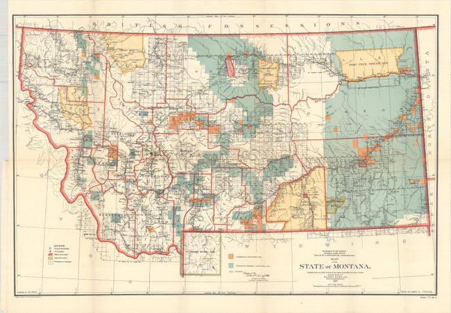
This colorful map details the extent of public surveys in Montana along with well-developed watershed and topography. It shows Indian reservations (Blackfeet, Flathead, Fort Peck, Crow, etc.), military posts, and numerous railroads. The map locates Crow Agency, Custer Monument and Battlefield, and the Reno battlefield, as well as Yellowstone National Park in its entirety including major features. The legend identifies land offices, Surveyor Generals Office, military reservations, Indian reservations, and townships not yet subdivided. Settlement and political detail include counties, county seats, towns, villages, and railroad stations. One of the main features on this edition is the identification via color of townships containing coal or probably containing coal. Originally drawn in 1897, this issue carries updates to Dec. 19, 1906. Made under the direction of Harry King, Chief of Drafting, GLO.
References:
Condition: A
A colorful example, issued folding, with two tiny splits at the fold junctions.