Subject: Michigan
Period: 1848 (circa)
Publication: A New Universal Atlas
Color: Hand Color
Size:
11.6 x 14.6 inches
29.5 x 37.1 cm
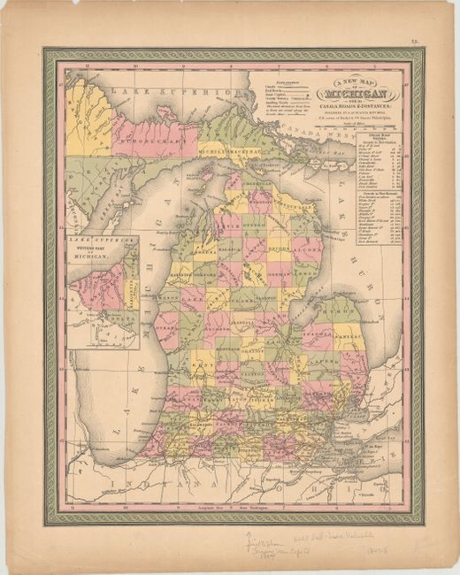
This attractive, colorful map features county development throughout, but no settlement beyond Saginaw, with the notable exception of Mackinaw Island. Railroads are shown only in the extreme southern portion of the state. It includes an inset of the western tip of the Upper Peninsula, showing Ontonagon County and parts of Marquette, Houghton, and Delta counties. The table to the right gives the cities and distances along the steamboat routes from Detroit to Fort Gratiot and then continuing to Fort Howard. On this example, Lansing is shown as the capital, replacing Detroit, which was the capital from 1805 to 1847. The map is adorned with calligraphic title and scroll borders.
References:
Condition: B+
Contemporary color with toning and some small chips and edge tears confined to the blank margins.