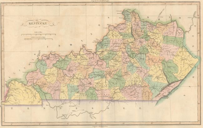
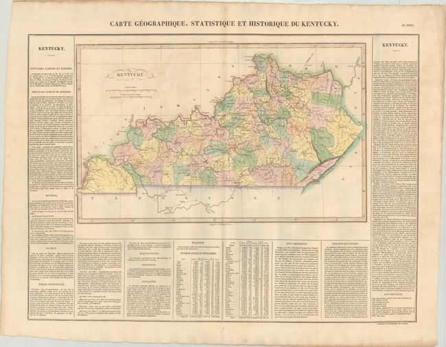
Subject: Kentucky
Period: 1825 (published)
Publication: Atlas Geographique, Statistique, Historique ... des Deux Ameriques
Color: Hand Color
Size:
18.1 x 11.1 inches
46 x 28.2 cm
This attractive copper engraved map details counties (each in full hand coloring), roads and towns. It is surrounded on three sides with French text describing Kentucky - its history, religions, etc. The size given is for the map only; it is on a large folio sheet measuring 27.1 x 21.3". Buchon produced the French edition of Carey & Lea's American Atlas. He used a better quality paper and today his maps are generally found in better condition than their American counterparts.
References:
Condition: B+
Contemporary color with light toning and offsetting, minor scattered foxing, and a printer's crease at left. A small hole in an unengraved area in the text box at top right has been repaired on verso with archival materials.