Subject: Chicago, Illinois
Period: 1858 (dated)
Publication: Sen. Ex. Doc. 1, 35th Congress, 2nd Session
Color: Black & White
Size:
48.4 x 31.2 inches
122.9 x 79.2 cm
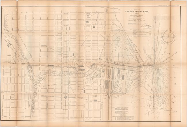
This early, large format map of Chicago Harbor depicts the North Pier, the South Pier, as well as the proposed extension to the South Pier. Both the harbor and the Chicago River are filled with information including soundings, buoys, navigational hazards and notations. Along the lake shore, the numerous buildings and rail lines of the Illinois Central Railroad are depicted. In the city, streets are named, but there is little additional information beyond a few buildings including City Hall, the Marine Hospital, and several churches. Drawn on a scale of 200 feet per inch, this map accompanied Graham's report to the Chief Engineer.
References:
Condition: B
Issued folding with light toning, minor offsetting, and trimmed to the border at left. There are numerous fold separations that have been mostly repaired on verso, and an 8" edge tear at top left that has also been closed on verso with archival tape.