Catalog Archive
Auction 182, Lot 246

"[Lot of 3] Map of Los Angeles County Highways... [and] Map Showing Territory Annexed to the City of Los Angeles California [and] Map of the City of Los Angeles Showing Streets Grated, Oiled and Paved",

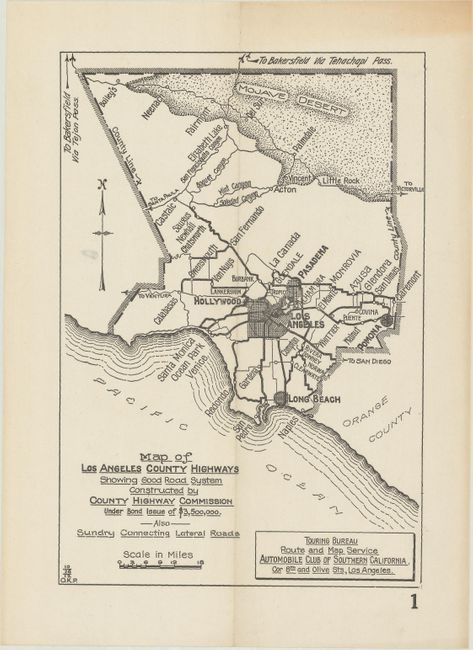
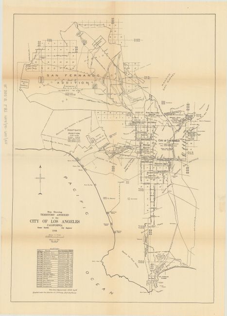
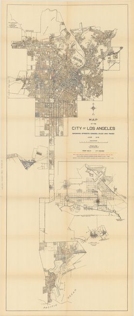
Subject: Los Angeles, California

Period: 1912-16 (dated)

Publication:

Color:

Size:
See Description
Download High Resolution Image
(or just click on image to launch the Zoom viewer)

Three maps showing the evolving infrastructure of Los Angeles, especially roads, as it attempted to deal with a population explosion from 100,000 in 1900 to over 400,000 by 1916.

A. Map of Los Angeles County Highways Showing Good Road System Constructed by County Highway Commission Under Bond Issue of $3,500,000. Also Sundry Connecting Lateral Roads, by Automobile Club of Southern California, dated 1912, black & white (5.8 x 8.5"). This map shows the network of the earliest improved roads in Los Angeles resulting from the construction program supported by the first road bond issue of 1908. For a detailed history of early highway development in Los Angeles, see the article by Burt A. Heinly on page 306 of the May, 1910 issue of Municipal Engineering. Heinly noted that L.A. had more automobiles per capita than any other city “perhaps for the reason that autoing is possible every day of the year” and that “hundreds of wealthy tourists bring their machines with them.” As a result, citizens gave the bond issue “an unusually large vote in favor.” No examples located in OCLC or elsewhere. Condition: Minor toning confined to the top blank margin. (A)

B. Map Showing Territory Annexed to the City of Los Angeles California, by Homer Hamlin, dated 1916, black & white (12.7 x 17.9"). This map demonstrates how the city's footprint grew through a series of annexations from 1869-1916, with the Westgate and Occidental annexations occurring in 1916. Condition: Issued folding with a few tiny splits at the fold junctions. (B+)

C. Map of the City of Los Angeles Showing Streets Grated, Oiled and Paved, by Homer Hamlin, dated 1916, printed color (15.5 x 38.7"). This large map is color-coded to show the status of roads in 1916. Road types identified include graded and oiled in 1916 (yellow), paved in 1916 (red), previously graded and oiled (brown), and previously paved (blue). Includes insets of the San Fernando Valley and Westgate addition. Condition: Issued folding on fragile paper with a number of fold separations closed on verso with archival tape. (B)

References:

Condition:

See description above.

Estimate: $200 - $230

Sold for: $550

Closed on 4/28/2021

Archived