Subject: Southern California
Period: 1847 (dated)
Publication: Ex. Doc 1, 30th Congress, 1st Session
Color: Black & White
This lot of four government-issued maps displays troop positions and actions in Southern California during the Mexican-American war. These maps were published in the Message from the President of the United States to the Two Houses of Congress at the Commencement of the First Session of the Thirtieth Congress in 1847.
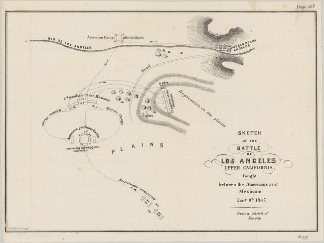
A. Sketch of the Battle de Los Angeles Upper California, Fought Between the Americans and Mexicans Jany. 9th 1847 (8.3 x 5.8"). A very early map showing Los Angeles. Locates the Pueblo de Los Angeles, the Rio de Los Angeles, and the moving positions of forces during the battle. Condition: There are a few minor spots and the margins have been trimmed on all sides, but they are still adequate for framing. (B+)
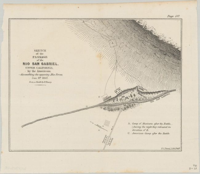
B. Sketch of the Passage of the Rio San Gabriel, Upper California, by the Americans, -- Discomfiting the Opposing Mex: Forces, Jan: 8th 1847 (8.1 x 6.3"). Shows the American troops advancing across the Rio San Gabriel and the resulting withdrawal of Mexican forces. Condition: There are a couple of spots of foxing along the centerfold, otherwise fine. (A)
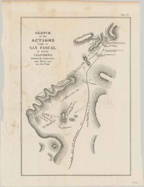
C. Sketch of the Actions Fought at San Pascal in Upper California Between the Americans and Mexicans Dec. 6th & 7th 1846 (7.8 x 11.1"). Depicts the battle between Kearny's troops and those of Mexican Major Andres Pico. Once reinforcements arrived, Kearny was able to push Pico's troops south and reach San Diego. Condition: Light foxing and minor soiling. (B+)
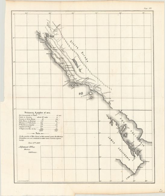
D. [Untitled - Map of the California Coast] (11.9 x 14.5"). Covers the California coast from Fort Sacramento south with an inset of lower Baja California. It displays the route of the American militia from Sutter's Fort to San Diego from mission to mission. There is a key at left that gives the number of men present between different points of the march. Condition: On a clean bright sheet with a few creases at bottom left. (A)
References:
Condition:
Issued folding. See description above for details.