Subject: Carmel, California
Period: 1930 (circa)
Publication:
Color: Black & White
Size:
21.9 x 14.9 inches
55.6 x 37.8 cm
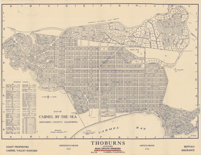
This real estate map by George C. Thomas shows Carmel's detailed subdivision plan with individual lots numbered. The hatched section at the center of the map is noted as the business district and identifies the Pine Inn, La Ribera Motel, Monte Verde Apartments, Library, and a "Bank Block." Along the Carmel Bay coastline are four planned additions, fueled by population growth that saw the burgeoning town grow from 638 in 1920 to 2,260 in 1930 (a 254% increase). Includes a street index at lower left. Issued by Thoburns Real Estate Brokers.
References:
Condition: A
Issued folding with a few tiny splits at the fold junctions and a small pencil notation.