Catalog Archive
Auction 182, Lot 239

"A Cartograph of Monterey Bay Region - California's Greatest and Most Accessible Scenic Playground! ", White, Ruth Taylor

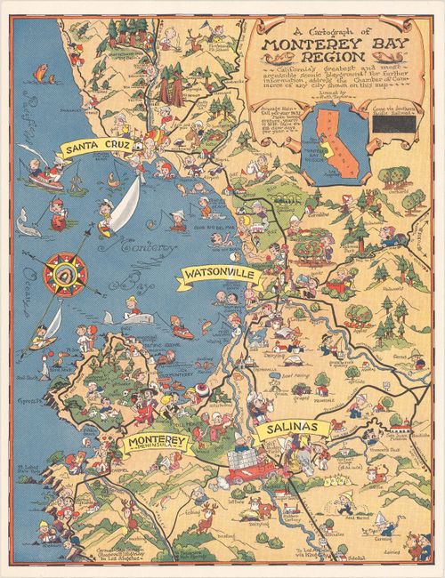
Subject: Monterey Bay, California

Period: 1933 (circa)

Publication:

Color: Printed Color

Size:
8.1 x 10.4 inches
20.6 x 26.4 cm
Download High Resolution Image
(or just click on image to launch the Zoom viewer)

This is one of White's rarer pictorial maps, and shows the region surrounding Monterey Bay, a popular tourist destination. The map includes Carmel Highlands, Santa Cruz, Watsonville, and Salinas and shows the roadways and scenic sights in the area. The title notes that the area is "California's greatest and most accessible scenic playground." Just below the title it states "Come via Southern Pacific Railroad" and below is a redacted portion that previously stated "Pacific Greyhound Bus Lines - or in your own car - or plane." We've only encountered two other examples of this map for sale, neither of which have the redacted portion, making this example very unique.

References: Rumsey #11344.

Condition: A+

Clean and bright.

Estimate: $200 - $250

Sold for: $150

Closed on 4/28/2021

Archived