Subject: Arizona
Period: 1905-10 (published)
Publication:
Color: Printed Color
Size:
16.8 x 20.3 inches
42.7 x 51.6 cm
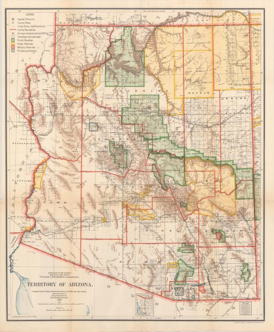
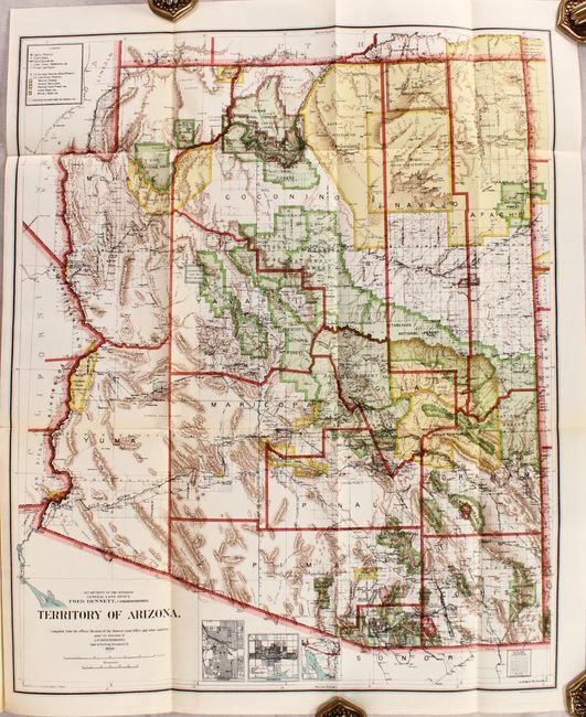
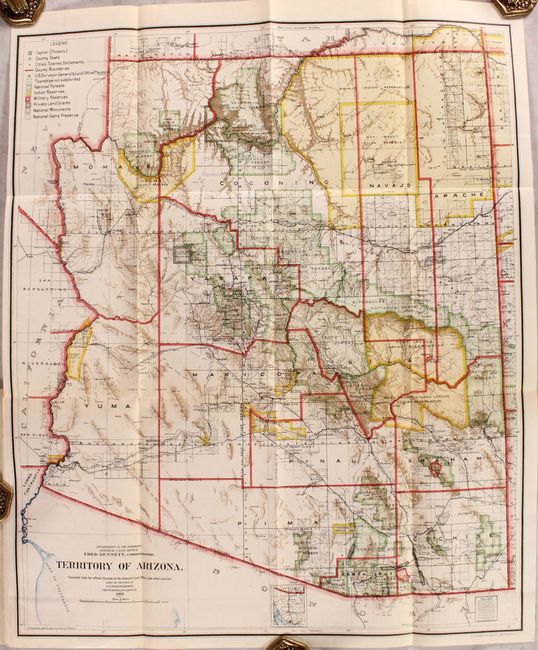
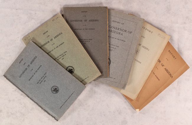
A fine collection of six reports (1905-10) by the Governor and accompanying General Land Office maps that show the evolution of Arizona Territory as it approached statehood. Each map measures approximately 17 x 20" and shows Indian reservations, military reservations, and National Forest Reserves in vibrant color. Brown hachured mountainous areas and blue waterways combine to provide further visual impact. Details include watershed, mountains, railroads, wagon roads, private claims, unsurveyed townships, and more. Each map is folded into its respective report. Octavo, printed paper wrappers.
References:
Condition: A+
Condition code is for the folding maps, which are clean, crisp and fine. Paper wrappers have light wear and three of the reports are missing the rear wrapper (1905, 1908 and 1910).