Subject: Southwestern United States
Period: 1960 (dated)
Publication:
Color: Printed Color
Size:
27.3 x 20.5 inches
69.3 x 52.1 cm
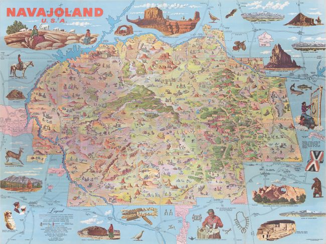
This stunning pictorial map of the Navajo Nation was drawn by illustrator Don Bloodgood for the Navajo Tribal Parks Commission. It depicts the 16,000,000 acre stretch of land in northeastern Arizona, northwestern New Mexico, and southeastern Utah. Bloodgood fills the landscape with small illustrations showcasing Navajo culture and the region's many landmarks and sites of interest. Larger illustrations surrounding the map depict Monument Valley, sheep raising, rug weaving, Window Rock, several sacred mountains, and more. A legend at bottom indicates highways, "primitive roads," Navajo rug weaving areas, gas stations, airports or landing strips, and tribal police stations. The Four Corners is noted. At the time of the map's publication, the Navajo population was approximately 90,000. This is the first edition; a later edition was published in 1968.
References:
Condition: B+
Issued folding with minor wear along the fold lines and a few tiny fold separations closed on verso with archival tape.