Subject: Northwestern United States
Period: 1865 (dated)
Publication:
Color: Hand Color
Size:
23.3 x 17.1 inches
59.2 x 43.4 cm
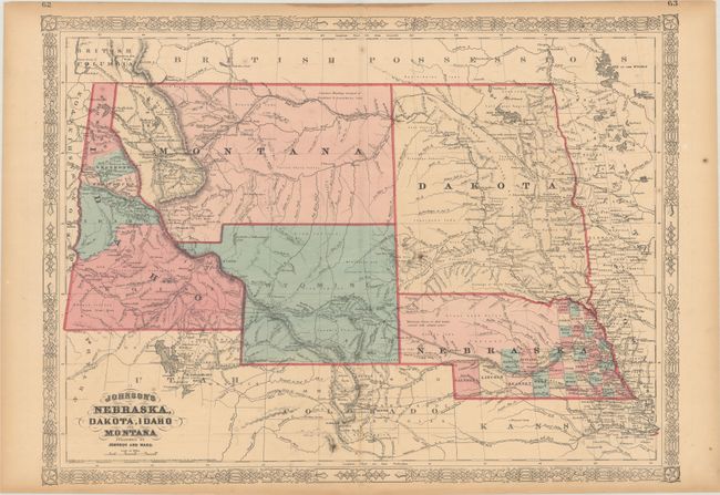
This colorful double-page map published circa 1865-66 shows a very early rendering of Wyoming Territory, organized in 1868. The territory's western boundary is not correctly formed; a pointed projection extends into present-day Idaho in the northwest, with Idaho occupying western Wyoming south of Jackson Hole. The map correctly delineates Montana which, along with Wyoming, was previously contained in a large Idaho territory. Dakota Territory, from which Wyoming was formed, remains undivided. There is excellent detail throughout with scores of place names, roads, watershed, topography, the Emigrant Road, forts, springs, routes of exploration and proposed railroads. The route of the Pony Express & U.S. Mail Route through Utah, Wyoming and Nebraska is delineated. According to the Johnson Map Project, this is version 1.0.
References:
Condition: B+
There is light toning, scattered foxing, and a thin dampstain along the top sheet edge. A short centerfold separation at bottom has been closed on verso with archival tape.