Subject: Great Plains
Period: 1858 (circa)
Publication: Sen. Ex. Doc. 1, 35th Congress, 2nd Session
Color: Black & White
Size:
10.3 x 9.1 inches
26.2 x 23.1 cm
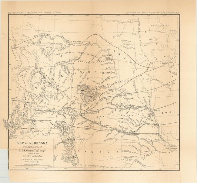
This map of the northwestern Great Plains covers the region from Lake of the Woods to the Rocky Mountains, and from the Canadian border south to the Arkansas River. It is based upon explorations of the region by Warren as well as other sources including the Government Land Office, Pacific Railroad Surveys, Stansbury and Fremont. A large "unexplored" area occupies the region above the Black Hills with four routes in the vicinity that "should be examined" heading west. Along the top of the map is Governor Stevens' proposed northern railroad from Ft. Ripley to Lewis Pass. Issued in the Annual Report of the Office of Explorations and Surveys.
References: Wheat (TMW) #937.
Condition: B
Issued folding with a small binding trim at bottom left and a 0.5" fold separation also at bottom left that has been closed on verso with archival tape. There is light toning along the folds and some faint offsetting.