Subject: South Central United States, Texas
Period: 1891-95 (published)
Publication: Atlas to Accompany the Official Records of the Union and Confederate Armies...
Color: Printed Color
Size:
27.3 x 16.4 inches
69.3 x 41.7 cm
Four maps of Texas and the surrounding region that were issued in Atlas to Accompany the Official Records of the Union and Confederate Armies:
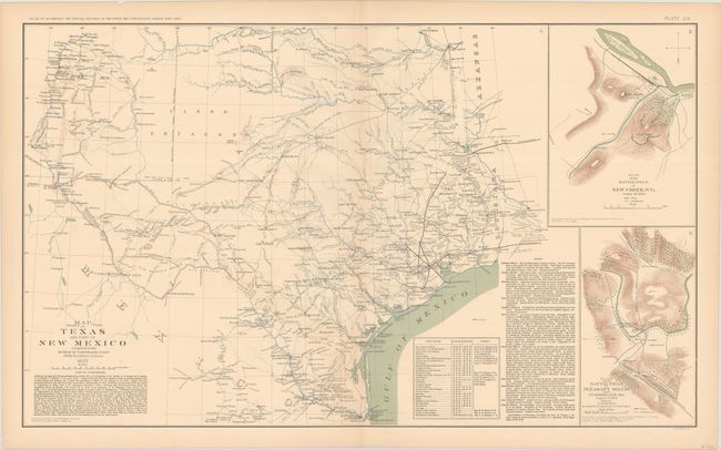
A. Map of Texas and Part of New Mexico Compiled in the Bureau of Topographl. Engrs. Chiefly for Military Purposes. This finely lithographed map of the state has much detail throughout. It locates settlements, forts, trails, and fords, with topography and watershed shown. The map contains extensive notes on rivers, a list of authorities, and a table of stations with locations and authorities. Martin & Martin say, "With the onset of the Civil War, the federal exploration and mapping efforts in the West ceased, and many federal troops there either withdrew or surrendered … Shortly after assuming command of the Gulf in 1862 and while planning his offensives in New Orleans, Banks dispatched a report to Washington containing a map of the Texas region. The map had been prepared from various sources shortly before the war, and it was an excellent example of a military planning document…" It was originally drawn in 1857 and was utilized by Banks in 1862, but was not published until its appearance in the Official Records atlas of the 1890's. This historical map documents the status of the frontier immediately prior to the outbreak of the Civil War. With two unrelated inset maps at right: "Plan of Battle Field at New Creek West Virginia August 4th 1864" and "Plan of Battle at Pleasant Mills near Cumberland Md. August 1st 1864."
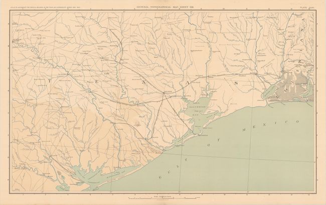
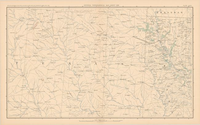
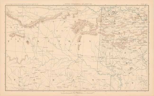
B. General Topographical Map. Sheet XXII [and] ...Sheet XXIII [and] Sheet XXIV. These three maps together span an area from the Texas coastline north to Indian Territory and Arkansas. The sheets include excellent detail of rivers, lakes, marshes, bays, and topography. Towns and cities, post offices, roads and railroads are also located.
References: Martin & Martin #45.
Condition: B+
Mostly clean and bright with some color offsetting that is most prominent on topographical sheet XXII. There are several short fold separations and edge tears mostly confined to the margins that have been closed on verso with archival tape.