Subject: South Central United States, Arkansas
Period: 1828-62 (circa)
Publication:
Color: Hand Color
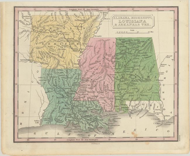
A. Alabama, Mississippi, Louisiana & Arkansas Ter., by John Grigg, from American School Atlas, circa 1828 (9.6 x 7.9"). This scarce and finely engraved map of the southern states shows Arkansas Territory in the transitional period after 1824 and prior to the establishment of its final western boundary in 1828. It is one of only a few maps to show the territory in this configuration. Engraved by J.H. Young. Condition: Contemporary color with a couple light spots at bottom. (B+)
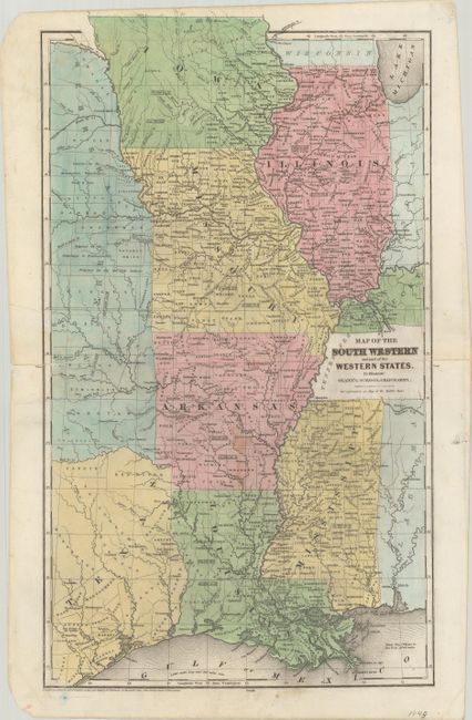
B. Map of the South Western and Part of the Western States. To Illustrate Olney's School Geography, by Jesse Olney, from Olney’s School Geography, dated 1844 (10.4 x 17.9"). Despite the title, this map covers the southern part of the Central United States including Illinois, Missouri, Arkansas, Mississippi, and Louisiana with parts of Indiana, Kentucky, Alabama, Nebraska, Indian Territory, and Texas. Much of northern Iowa is labeled as “Neutral Ground” referring to Winnebago reservation intended to protect the tribe from the Sioux, Sac, and Fox tribes. In Texas, the elusive Spring Creek County appears (although it only existed between 1841 and 1842). There are several interesting notations concerning tribal lands in Indian Territory. Published by D.F.Robinson. Condition: There are a couple of light stains near center. Centerfold separations at left and right have been closed on verso with archival materials. (B+)
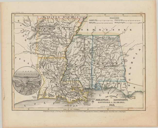
C. Die Staaten von Arkansas, Mississippi, Louisiana & Alabama, by Hildburghausen Biblio Institut, from Meyer's Zeitungs-Atlas, dated 1853 (10.5 x 7.8"). This attractive steel engraved map has very nice detail of the major cities, roads, and railways. Little Rock is also named Arkopolis. There is a circular inset of New Orleans and vicinity at left. Condition: Marginal toning. (A)
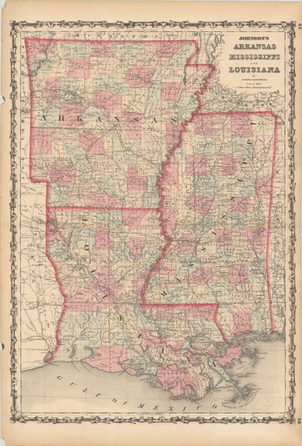
D. Johnson’s Arkansas Mississippi and Louisiana, by Johnson & Browning, from Johnson’s New Illustrated (Steel Plate) Family Atlas, circa 1860 (17.1 x 24.1"). A very detailed map of Arkansas, Louisiana, and Mississippi published during the Civil War. County configuration of Arkansas is current to 1859, prior to the creation of Cross and Woodruff counties in 1862. This edition appeared in Johnson's atlas between 1860-62. Condition: Contemporary color with light toning along the centerfold and sheet's edges, some small abrasions in Rapides Parish, and some small chips and tears in the blank margins. (B+)
References:
Condition:
See description above.