Subject: World
Period: 1860 (dated)
Publication:
Color: Hand Color
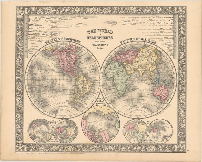
A. The World in Hemispheres. With Other Projections &c. &c. (13.0 x 11.1"). A lovely double hemisphere map with Mitchell's unique floral border. Below the world map are three smaller maps: The World on a Polar Projection; North Polar Region; Land and Water Hemispheres. A comparative diagram of the world's rivers is shown above the maps with the note "Sea of Uniamezi Probable Source of the Nile".
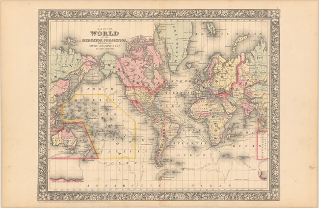
B. Map of the World on the Mercator Projections, Exhibiting the American Continent as Its Centre (17.8 x 14.1"). This crisply engraved map with the Western Hemisphere at center features the tracks of several explorers including Cook, Gore, and Ross. In this first edition map, the continent of Antarctica is named, but only small portions of its coastline are delineated, naming Graham's Land, Palmer's Land, and showing the track of the U.S. Exploring Expedition. The Trans-Atlantic telegraph cable is shown between Newfoundland and Ireland. Alaska is shown here as Russian Territory.
References:
Condition: B+
Mostly clean and bright with some light scattered foxing.