Subject: Southern United States, Gulf Coast
Period: 1867 (dated)
Publication:
Color: Hand Color
Size:
38.2 x 23.9 inches
97 x 60.7 cm
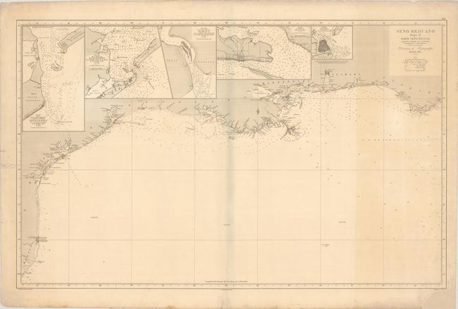
This very uncommon sea chart depicts the Gulf Coast along the states of Texas, Louisiana, Mississippi, Alabama and a small portion of Florida. The map is inset with small charts of Matagorda Bay, Galveston Bay, the mouth of the Sabine River, Biloxi Bay, and San Luis Pass. The mouth of the Mississippi is well charted with the city of New Orleans and Lake Ponchartrain, and there is good detail of the bays of Mississippi, Mobile and Pensacola. The chart notes soundings, hazards and lighthouses, which have been hand colored in red and yellow. First edition. Embossed with the stamp of the Direccion de Hidrografia in Madrid at lower left. Spanish sea charts are among the finest, and scarcest of all working charts. They are uncommonly offered on the market.
References:
Condition: B+
On a sturdy watermarked sheet with some light toning at right and a couple of small cuts at bottom left that have been repaired on verso with archival materials. There are repairs to several edge chips and tears in the margins, including one that just enters the border at left.